
Devon and Somerset Fire and Rescue Service utilises Idox Bluelight Gazetteer to protect the vulnerable in Plymouth’s bomb evacuation
Idox Bluelight Gazetteer at the heart of the Service’s Operation Foster
We used the Bluelight address data to link to our prevention and risk systems via UPRNs. This simple process underpinned the work we carried out supporting our vulnerable residents and identifying additional risks.
Amy Down
Enterprise Data Manager, Devon & Somerset Fire and Rescue
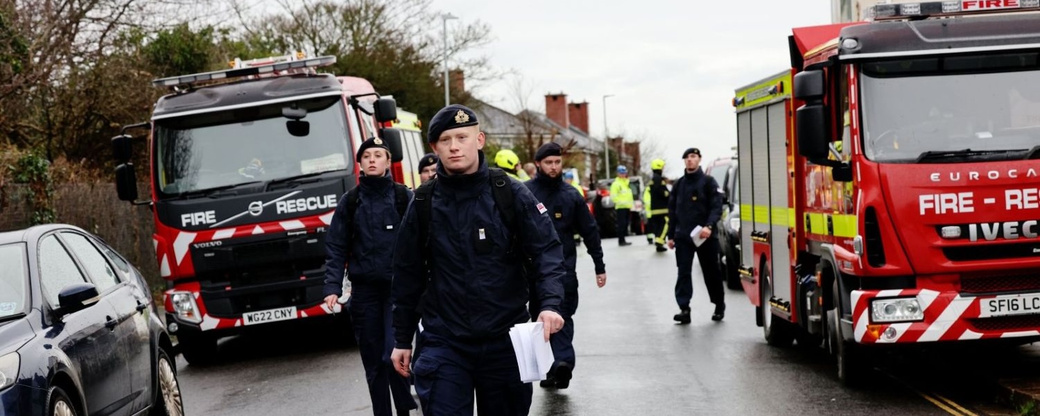
Background: the incident
On 20 February 2024, a 500kg World War II German bomb was discovered in a garden on St Michael Avenue, Keyham, Plymouth. A major incident was declared, triggering one of the UK’s largest peacetime evacuations. An initial 300m cordon affected more than 1,200 properties and 3,000 residents. As the operation developed, the evacuation zone extended along the bomb’s transport route to the Torpoint Ferry slipway, eventually displacing over 10,000 people.
The bomb was moved by military convoy and safely detonated at sea in Plymouth Sound. A local recovery programme then repaired damaged properties and supported displaced residents.
Devon and Somerset Fire and Rescue Service worked alongside the military, police, ambulance service, local authority and voluntary agencies. Their challenge was to identify and protect vulnerable people while managing additional risks such as oxygen cylinders, fuel stores and flammable materials.
Using Idox Bluelight Gazetteer to inform evacuation
The Bluelight Gazetteer Management System (GMS) provided a critical foundation for linking address data with risk and vulnerability information in real time, supporting rapid, accurate decision-making during a fast-moving incident.
Address-centric risk intelligence
Using the Bluelight GMS, the Service linked prevention and risk-management datasets to address records via Unique Property Reference Numbers (UPRNs). These datasets included information on vulnerable residents, such as those reliant on medical oxygen or with mobility issues, and properties containing hazardous materials.
“We used the Bluelight gazetteer address data to link to our prevention and risk systems via UPRNs. This simple process underpinned the work we carried out supporting our vulnerable residents and identifying additional risks,” says Amy Down, Enterprise Data Manager for the Service.
This single, authoritative address base meant that once exclusion-zone polygons were drawn, the Service could instantly identify addresses with vulnerable residents or hazards. Crews prioritised evacuations, arranged transport, removed dangerous equipment and allocated rest-centre resources efficiently.
Fast, accurate data when every second counts
As the situation evolved rapidly, the Bluelight gazetteer enabled the Service to:
- instantly identify all addresses within the cordon
- filter for vulnerability and hazard flags
- update records as the cordon expanded
- share actionable data with evacuation teams, rest centres and liaison officers.
Using a shared, authoritative address dataset reduced duplication and error when clarity was critical.
Operational support on the ground
Address-linked vulnerability data enabled the Service to:
- arrange specialist transport and medical equipment
- support residents who chose not to evacuate by installing sandbags, removing hazards and providing supplies
- maintain accountability by logging visits, decisions and conversations against property records via UPRNs
- share accurate, consistent data across agencies.
The Bluelight gazetteer provided a single, trusted view of residents’ needs, supporting coordinated multi-agency working.
The Service was at the heart of the planning, using the Bluelight GMS to link vulnerable persons data and associated risks to location data, helping those most at risk
Amy Down
Enterprise Data Manager, Devon & Somerset Fire and Rescue
Adapting to a developing situation
When the evacuation zone extended along the convoy route, the Service simply redrew the exclusion polygon in the GMS and re-ran address-based queries. New addresses were instantly identified, with risks and vulnerabilities already linked, ensuring no household was missed.
Recovery and return-home support
After detonation, the same address-linked data supported recovery by:
- identifying damaged properties and coordinating repairs
- reinstalling medical and safety equipment
- logging follow-up visits for ongoing support.
Using the Bluelight GMS throughout ensured continuity from evacuation to recovery.
Outcomes and benefits
Operation Foster demonstrated how the Bluelight gazetteer turns complex data into clear operational intelligence. Benefits included:
- rapid access to accurate address and risk data
- a single source of truth across teams
- clear visibility of vulnerable people and hazards
- flexibility as cordons changed
- seamless multi-agency collaboration using UPRNs.
Beyond day-to-day use
Typically used for address management, appliance deployment and risk mapping, the Bluelight GMS proved invaluable during a high-stakes emergency.
“This was an intensely complex and dangerous operation. The Service were at the heart of the planning, using the Bluelight GMS to link vulnerable persons data and associated risks to location data, helping those most at risk,” adds Amy Down.
The Bluelight GMS was the invisible backbone of the response, transforming address data into life-saving intelligence and enabling the Service to act quickly, protect the vulnerable and coordinate with precision.