
Using local nicknames to help emergency services pinpoint precise locations
While it may seem amusing to send emergency services to an incident at Drinking Dinosaur or Slippery Bottom, being able to pinpoint the exact location quickly could mean the difference between life and death.
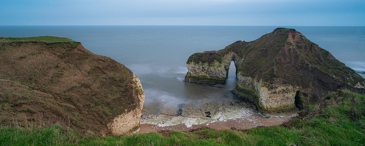
Developed by Ordnance Survey as a component dataset of its new Emergency Services Gazetteer (ESG), the Vernacular Names Tool comprises the colloquial names for more than 9,000 landmarks. From Drinking Dinosaur, a cliff formation at Flamborough Head in East Yorkshire to Slippery Bottom in Norfolk, these locally known nicknames are commonly used by locals but would be unlikely to appear on any map, making it difficult and time-consuming for emergency services to find the exact location of an incident.
Using local nicknames
The OS’s new, vernacular names dataset is a replacement for the FINTAN system that HM Coastguard has been using for the last 10 years. This recorded locally known names for coastal areas so the public could use them in an emergency situation. The OS’s new dataset combines these names with new nicknames provided by bluelight organisations across the country. Being a dynamic dataset, local teams can add new names as they go.
Having access to data that has been specifically designed for and in conjunction with the emergency services is exactly what we need.
All the vernacular names are matched to other names the locations may have and are allocated the relevant Unique Property Reference Number (UPRN), if already in existence, or given a new UPRN if this is the first recording of the location. By doing this, a caller can use the vernacular name, or a different name if one already exists, and the UPRN will bind them together, ensuring emergency services are deployed to the right place.
The Emergency Services Gazetteer is more than just colloquial names
This vernacular names dataset is just one component of the new ESG that has been developed by the OS to help emergency services quickly reach incidents at locations not held on national datasets. In addition to these names, the ESG also holds the names and locations of road junctions with allocated UPRNs to identify their exact location. Later releases of the ESG will also include bridge interactions, i.e. information on bridges and the features they interact with, as well as the location of tunnels.
Idox asked its emergency services customers a few anonymous questions to understand the importance of this new dataset. It’s clear to see how welcome it is:
Having access to data that has been specifically designed for and in conjunction with the emergency services is exactly what we need. We are mobilised to locations that are beyond the scope of AddressBase Premium so it will be beneficial to have this supplementary data with official UPRNs in our mobilising system.
Accessing the Emergency Services Gazetteer
Idox works with half the emergency services in Great Britain, providing its Bluelight Gazetteer Management System (GMS) to manage and share the OS’s AddressBase Premium data, along with any associated risk information. Having collaborated with the OS on the ESG project, Idox is now developing the GMS to enable bluelight organisations to supplement their AddressBase Premium data with this enriched ESG dataset. Due for an autumn release, the enhanced Bluelight GMS will give emergency services access to the richest, most targeted, verified location data, including AddressBase Premium, the ESG and locally added address records, all underpinned by UPRNs for pinpoint accuracy. With seamless integration with other operational systems, only the most precise data will be used for deploying emergency services, helping reduce response times and save more lives.